OUR RESEARCH AND OPINIONS ON:
350-Unit Trailer Park Project - Fire & Earthquake
The area of this proposal is a trifecta of hazard maps: fire, flood & fault zone.
Project Navigation
References
TL;DR
🔥 🌊 ⚠️ Fire. Flood. Fault Zone.
The proposed trailer park would sit in a very high fire hazard zone, along a natural flood path, and directly over the San Jacinto fault zone. Its likely fuel would need to be stored on site for a backup generator for the sewage system.
To us, this feels reckless.
And deeply out of step with what responsible planning looks like in 2025.
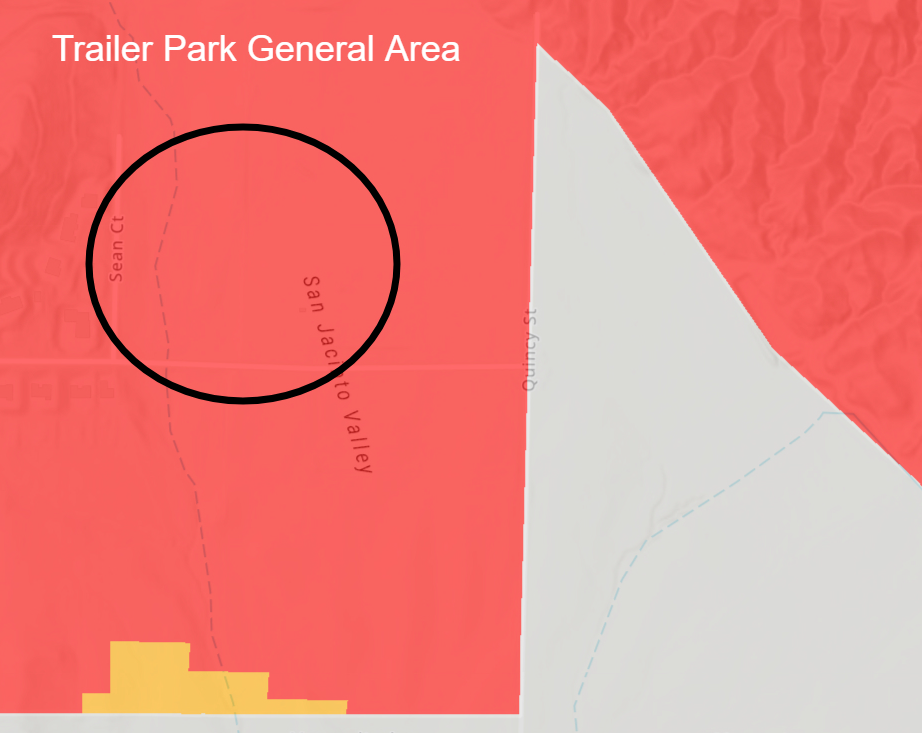
🔥 What the CAL FIRE Map Tells Us

The California Department of Forestry and Fire Protection (CAL FIRE) designates this area as a Very High Fire Hazard Severity Zone, the most serious category on the state’s fire risk map. That means the terrain, vegetation, wind patterns, and access limitations combine to create extreme wildfire conditions.
Fires in these zones spread fast, burn hot, and are difficult to contain.
Building dense housing here isn’t just risky; it increases the chance that residents and emergency crews won’t be able to get out in time.
Learn more about Fire Hazard Severity Zones at Cal Fire's site here.
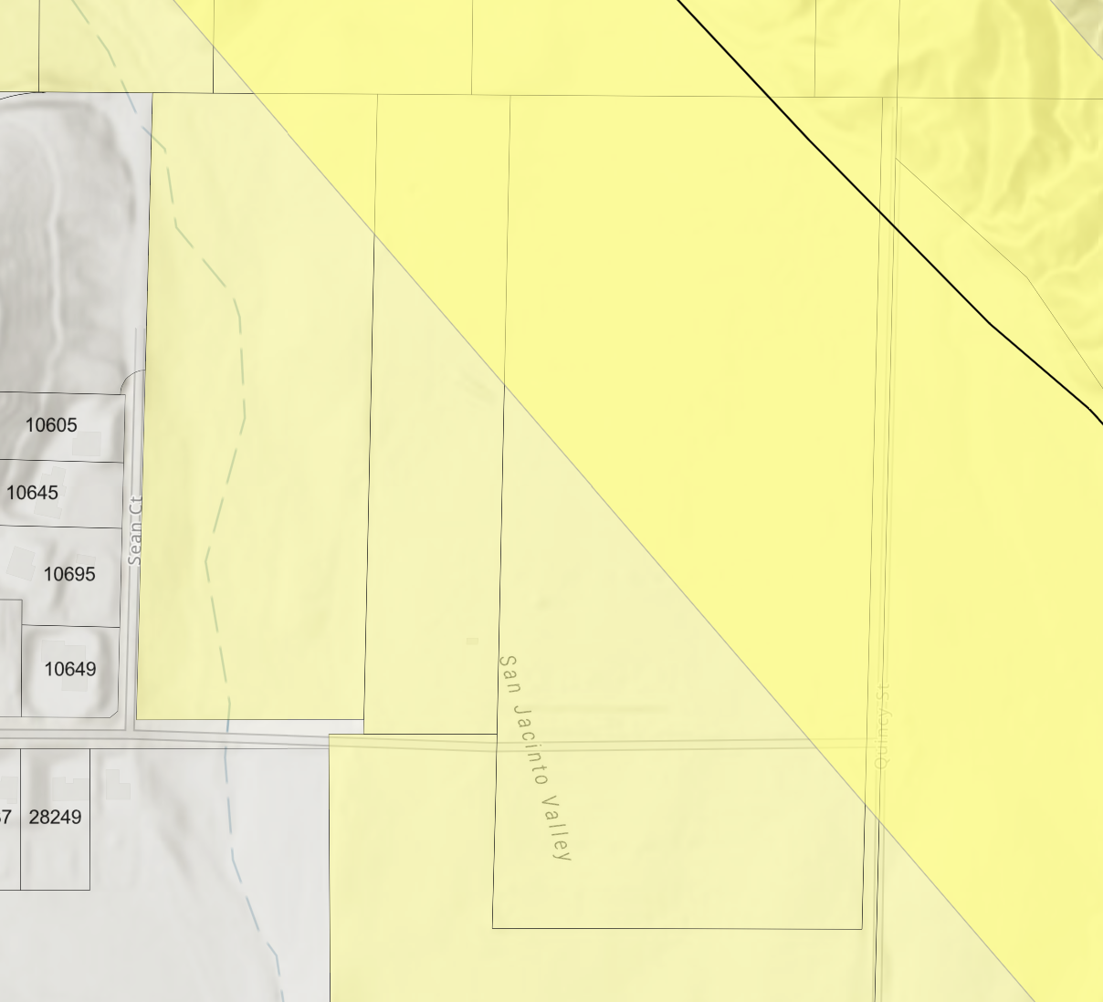
⚠️ What the Alquist-Priolo Map Tells Us

This site falls within an official Earthquake Fault Zone, as designated by the California Geological Survey under the Alquist-Priolo Act.
That means it lies in a mapped buffer around a known active fault, in this case, the San Jacinto fault system, one of the most hazardous in Southern California. The Claremont strand of this fault cuts through the eastern edge of Moreno Valley.
State law requires any new development in this zone to undergo a detailed geologic investigation to ensure that structures aren’t placed over active fault traces.
So far, no such study has been publicly disclosed.
This is not hypothetical. It’s a mapped seismic hazard zone, and a project of this scale should not move forward without full transparency and strict geological review.
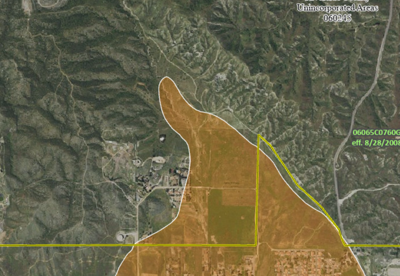
🌊 What the Flood Maps Tell Us

The proposed development site lies within a Special Flood Hazard Area (SFHA), as designated by FEMA’s Flood Insurance Rate Maps (FIRMs).
This classification indicates a 1% annual chance of flooding, commonly called the “100-year floodplain.” Being in an SFHA means the area is at significant risk for flooding, and any development here is subject to stringent building codes and insurance requirements.
Developing in such a zone without comprehensive flood mitigation measures endangers potential residents and strains emergency services and infrastructure.
It’s crucial to ensure that construction plans include robust flood protection strategies to safeguard people and property.
